SURVEYS AND MAPPING
with DRONE

AprFlyTech utilizza la più recente tecnologia UAV LIDAR per fornire nuvole di punti 3D di altissima qualità a livello di rilievo.
I dati LIDAR sono classificati dal nostro team di elaborazione per ricavare un DTM preciso e puntuale potendo escludere vegetazione e fabbricati creando curve di livello e sezioni senza interferenze.
La capacità del LIDAR di penetrare attraverso la vegetazione in aree boschive combinata con l'efficienza e la portata del sistema UAV lo rende uno strumento estremamente efficace per il rilevamento di aree estese, complesse e inaccessibili via terra.
SECTORS OF USE


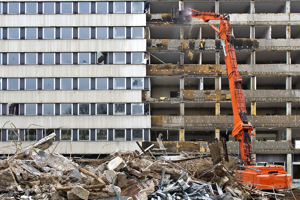
BUILDING


GIS


EXTRACTION

INFRASTRUCTURE

INDUSTRY

POWER
WHAT WE USE
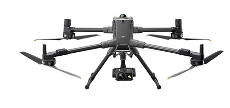
DJI Matrice 300 RTK
Latest drone born in DJI, a world leader manufacturer in the sector for companies, the main features are:
Flight autonomy up to 1H ;
Take-off weight based on installed PayLoads max 9kg;
Room dedicated to the flight for the pilot;
Possibility of installing several PayLoads at the same time ;
360 ° anti -collision obstacle system;
RTH Return to automatic take-off point;
ADS-B system to identify and warn of the presence of other aircraft;
Navigation lights and stroboscopic daytime and night position visible up to 3km;
Possibility of dual operator, pilot and payLoad operator;
All this sums up the most reliable and versatile remotely piloted aircraft ever produced to date for highly complex inspections and surveys.
DJI L1 Lidar
The Zenmuse L1 includes a Livox Lidar module, a high-precision IMU and a camera with a 1 "CMOS sensor on a 3-axis stabilized gimbal.
Livox Lidar module
Lidar framing with up to 100% effective point cloud results
Detection range: 450m (80% remission, 0 klx) / 190m (10% remission, 100 klx)
Effective point rate: 240,000 points / s
It supports 3 scan returns
Non-repetitive scan pattern or Repetitive scan pattern
1 "sensor, 20MP, mechanical shutter

Unprecedented precision
It renders accurate reconstructions down to the centimeter thanks to the high-precision IMU, a vision sensor for positioning accuracy and the incorporation of GNSS data.
Extraordinary efficiency
Generate point cloud models with true color or acquire 2km2 of data in point clouds in a single flight thanks to the Lidar module with Livox frame, FOV of 70 ° FOV and a light visible camera with 1 "sensor.
.jpg)
Unprecedented precision
It renders accurate reconstructions down to the centimeter thanks to the high-precision IMU, a vision sensor for positioning accuracy and the incorporation of GNSS data.

TEST

How drones power architectural engineering
Create 3D models with accurate positioning data that can easily be inserted into BIM models to visualize designs.
Designs can be optimized using 3D models created by drones compatible with a variety of GIS software.
Complete and detailed data
with an automatic survey process it is possible to detect large surfaces and complex structures while maintaining extremely high standards of precision and detail unthinkable before today.

the results obtained, with a photogrammetry survey with drone, offer a much higher amount of data and information than surveys with traditional methods
Orthomosaic
Photogrammetry allows to eliminate the perspective deformations present in the photographs, to obtain geometrically correct two-dimensional orthophotos. Mosaicing the orthophotos together, the Orthomosaic of an extended area is built, on which measurements can be made with centimeter accuracy.
Digital Terrain / Surface Models
The ground can be represented with Digital Surface Models (DSM), which indicate altimetric variations. Furthermore, if you are not interested in evaluating objects on the ground, such as trees or buildings, we can obtain Digital Terrain Models (DTM) that reproduce the real course of the terrain. Each product can be supplied with representations in various color scales and contour lines.


THE RESULTS
Complete and detailed data
with an automatic survey process it is possible to detect large surfaces and complex structures while maintaining extremely high standards of precision and detail unthinkable before today.
Data 2 D
Orthomosaic, Digital Terrain Model (DTM) and Contours, Elevation Planes ...
the results obtained, with a photogrammetry survey with drone, offer a much higher amount of data and information than surveys with traditional methods
Orthomosaic
Photogrammetry allows to eliminate the perspective deformations present in the photographs, to obtain geometrically correct two-dimensional orthophotos. Mosaicing the orthophotos together, the Orthomosaic of an extended area is built, on which measurements can be made with centimeter accuracy.
Digital Terrain / Surface Models
The ground can be represented with Digital Surface Models (DSM), which indicate altimetric variations. Furthermore, if you are not interested in evaluating objects on the ground, such as trees or buildings, we can obtain Digital Terrain Models (DTM) that reproduce the real course of the terrain. Each product can be supplied with representations in various color scales and contour lines.